Sanriku Geopark & Sanriku Fukko National Park

It’s Japan’s largest geopark, stretching out 220 km from Hachinohe, Aomori Prefecture, to Kesennuma, Miyagi Prefecture. It became Sanriku Geopark in 2013 as a learning field that conveys the history of global activities from about 500 million years ago and the memories of the repeated earthquakes in the Sanriku area to the next generations.
After the glacial period, the sea level rose, and valleys of the land were submerged along the rias coast, leaving the capes and coves intertwined. The bay with calm waves is suitable for cultivating oysters and scallops, but such terrain increases the tsunami’s height and worsens the damage. Sanriku Geopark teaches us this kind of truth as a “letterless textbook.”
In response to the Rikuchu Kaigan National Park area’s significant damage due to the Great East Japan Earthquake, in 2013 (2013), the park merged with the Tanesashi Kaigan Hshikamidake Prefectural Park and Hachinohe city in Aomori Prefecture with the aim of recovery from the earthquake and handing down the lesson about damage. The park took on the current name, later incorporating the Minami Sanriku Kinkazan Quaisai-National Park in 2015.
・ There are six geo-spots in Kamaishi city. The Kamaishi Mine is active, focusing on mining iron ore and copper ore, collecting natural mineral water “Sennin Hidden Water,” and running an electric power business. The operator converted the business to a company using driftways and related facilities. The limestone here took shape with deposits in the sea about 320 million years ago. The remains of the concentrator and the hopper utilized to transport the ore stay in the surrounding area. Valuable data are on display at the former Kamaishi Mine Office.
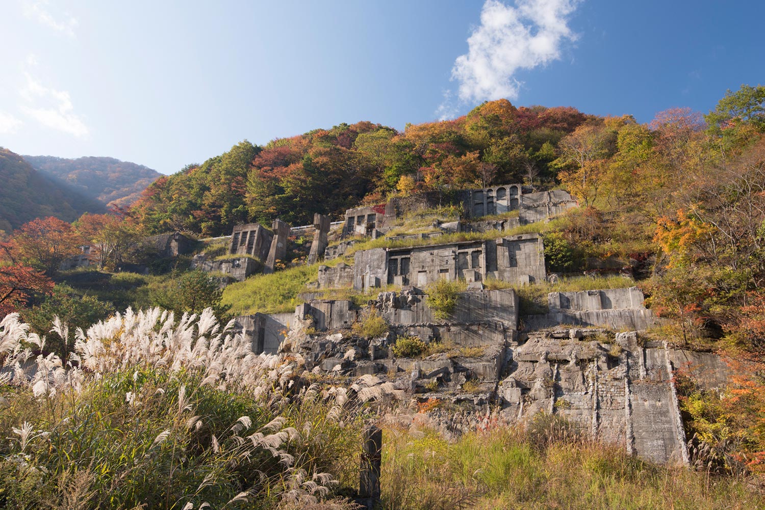
Location: Dai 3 Chiwari, Kasshicho, Kamaishi-shi, Iwate
・ The Hashino Iron Mine retains the remains of Japan’s oldest existing Western-style blast furnace, as well as the remains showing all the processes from iron ore mining to steelmaking, along with a beautiful landscape surrounded by nature-rich forests and rivers. The charcoal indispensable for ironmaking comes from the surrounding forest. The blast furnace’s stonework also uses nearby granite, indicating that ironmaking has continued by utilizing gifts from this area.
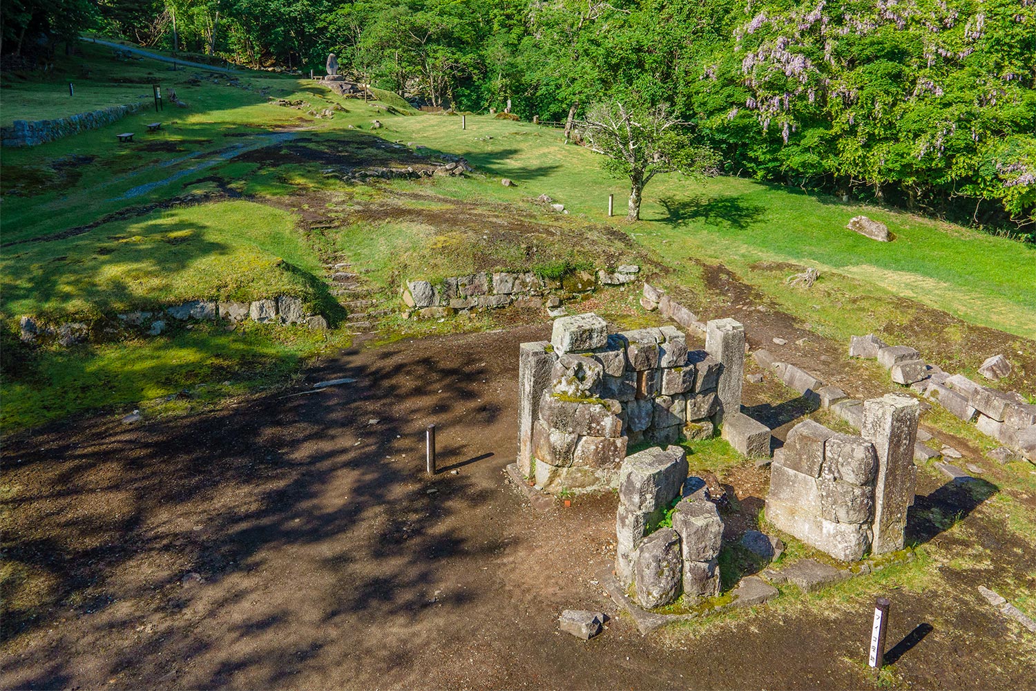
Location: 2-6, Hashinocho, Kamaishi-shi, Iwate
・ The Nebama Beach is a beautiful zone of white sand and blue pines facing the Otsuchi Bay. The beach once disappeared due to the tsunami and land subsidence during the Great East Japan Earthquake, but the beach revival project regenerated it. Iron sand deposited on this beach likely contains iron ore fragments from the Hashino Iron Mine. Mother Nature left rocks primarily exposed on the side of the road to the coast. They contain sediments and seamounts accumulated on the deep seafloor about 300 to 100 million years ago, moving on a plate.
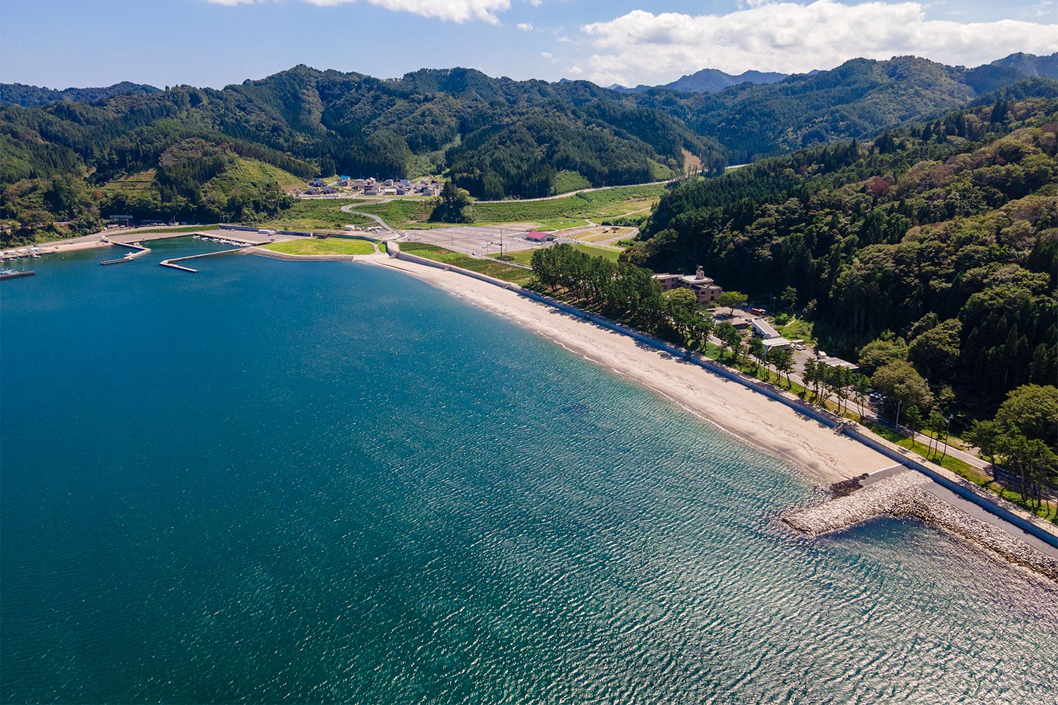
Location: 21-23, Unosumaicho, Kamaishi-shi, Iwate
・ Meiji and Showa Tsunami Monuments in Ryoishicho
Meiji and Showa tsunami monuments line up under the Sanriku Railway viaduct on National Route 45 from Ryoishicho to Unosumaicho. The Meiji Ryoishi Kaisho monument bears the phrases, “This monument may crumble, but the resentment remains,” and “Pass down the tsunami’s lesson to the descendants.”
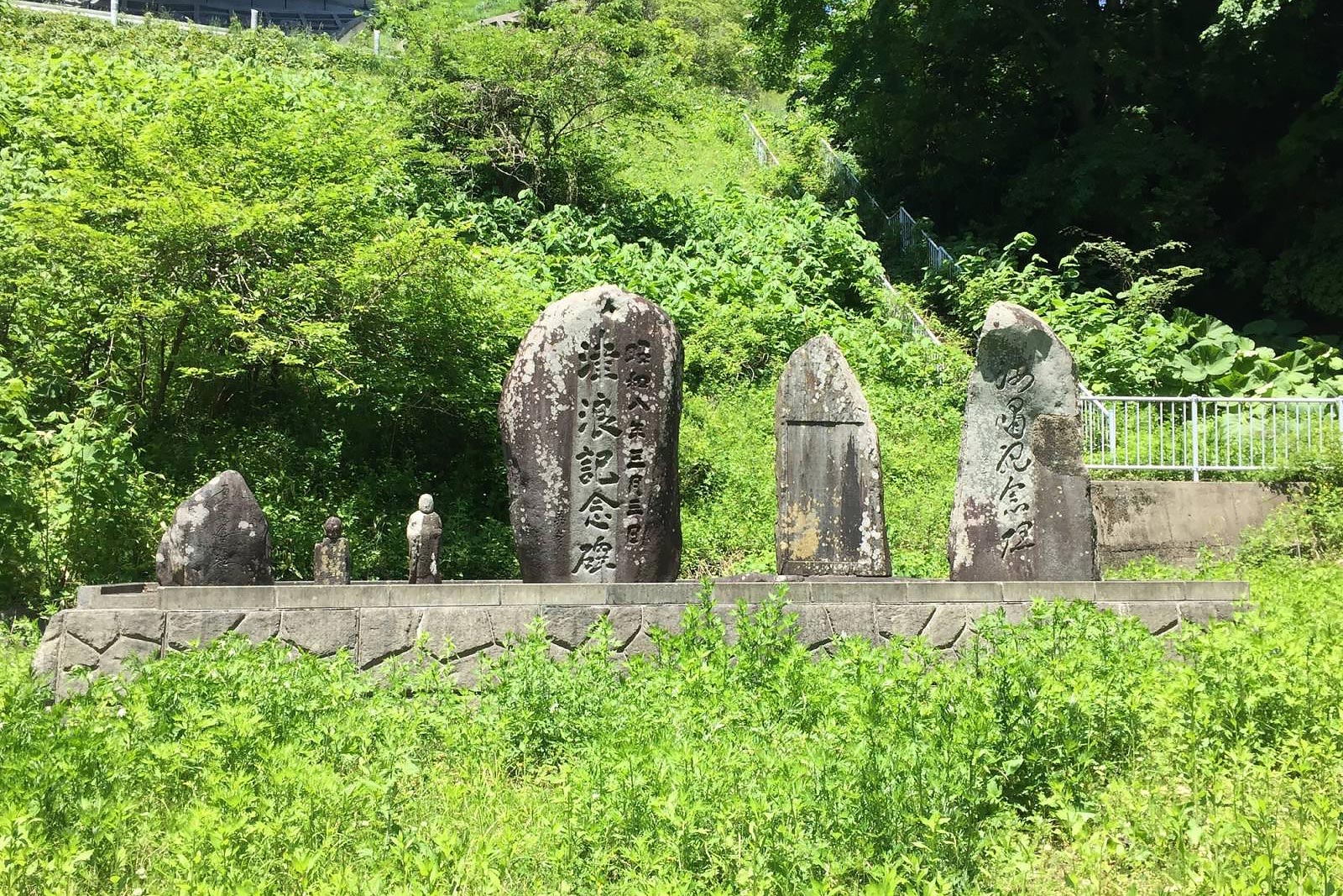
Loacation:Ryoishicho, Kamaishi-shi, Iwate
・ Senjogataki Falls
Lepidodendron was a plant that created the oldest forests on the earth in the latter half of about 420 to 360 million years ago. Scientists discovered its fossils at the top of the Senjogataki Falls layers. Being a plant peculiar to the time’s low latitudes provides crucial evidence that it was near the equator.The siliceous tuffaceous mudstone in the lower part of the Senjogataki formation, where fossils came out, contains radiolarians dating back 420 million or 400 million years. The Hayachine complex rocks date back to 470 million years or 460 million years. It tells us the structural development history of the Kitakami Mountains in the early to middle Paleozoic period.
・ Senjojiki (Ohakozaki)
The zone compared to a thousand tatami mats in the untouched wilderness located at the Hakozaki Peninsula’s tip reached via the Michinoku Shiokaze Trail and the Tohoku Nature Trail. The granite rock surface hardened as magma cooled about 120 million years ago is called the 1,000 tatami mats. It commanded a spectacular scene along with the Pacific Ocean seen through the Ohakozaki Lighthouse. The view of Sangan Island, a nationally designated natural monument, as a breeding ground for Streaked shearwaters and Swinhoe’s storm petrels, is also worth watching. It is a scenic spot loved by residents as “Ohakozaki.”
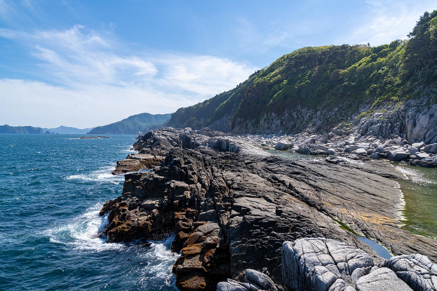
Loacation:Hakozakicho, Kamaishi-shi, Iwate